
What is sediment (silt)Silt is a fine sediment that can be found suspended in water or at the bottom of a water body forming soil. Physical (e.g frost shattering) and chemical (e.g rain) weathering break down surrounding rocks that then wash into our rivers and lakes.
Cromwell receives most of its sediment from the Kawarau river which in turn gets it from various rivers (e.g. Dart and Shotover), streams and waterfalls upstream. One study found the Shotover river carries between 1.6 and 2 million m³ of silt annually. Before the dam, the sediment would be carried down the Clutha river out to the pacific ocean 75km southwest of Dunedin. |
|
Why sediment is an issueFor over 30 years the Clyde Dam has prevented the natural transport of sediment from the Kawarau and Clutha rivers to the ocean. Reports created when the dam was being built concluded that sediment build-up was expected in the Kawarau Arm over time. The issue however is the poor management of its transition.
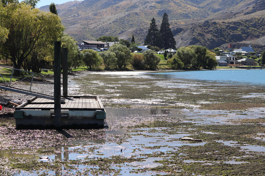
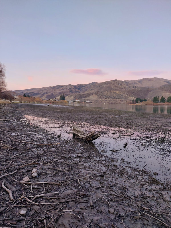
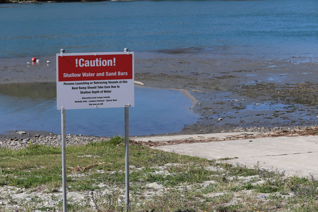
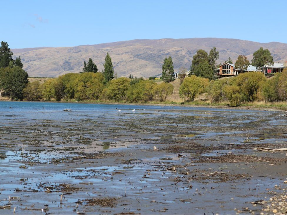
The Kawarau arm is no longer viable for swimming, fishing or boats due to silt deposits. The sediment build-up has resulted in the shift of the shoreline, loss of the jetty and shallowing of the boat ramp. The visual beauty of Old Cromwell is further impacted by the driftwood and Lagarosiphon that wash onto the sediment. Silty sediment is ideal for the aquatic weed Lagarosiphon major to establish. Efforts to control Lagarosiphon are regularly hampered by suspended sediment in the water that deactivates herbicides and hessian sacks, used to prevent weeds from rooting to the lakebed, are quickly covered. Sediment is typically high in organic matter which removes oxygen from the water as it decomposes. Lower oxygen levels result in changes to the pH and increased pollutant levels meaning native ecosystems collapse. Aquatic plant species are vital for the survival of native invertebrates, fish and birds dependent on them for food and shelter. This lack of oxygen levels also creates foul odours in the warmer month, further impacting recreation. |
|
Sediment management

|
Contact Energy is legally responsible for managing the visual effects caused by the Silt in the Kawarau arm. The Lakebed and shoreline of the Kawarau arm is Crown land, controlled by LINZ (Land Information New Zealand).
|
Ways to manage sedimentThe sediment arriving in Cromwell is a natural process that we cannot prevent useless if we build another dam. This however would only move the problem upstream and cost a substantial amount. The issue we face is how to manage the sedimentation and the transition of the Kawarau Arm.
Accelerating sedimentation and dredging are current methods being researched. Building up the sediment already settled will create a land that can be planted and landscaped for recreational use. Dredging the sediment and moving it elsewhere would allow access to the boat ramps and swim areas lost. Both come with benefits and problems. |
|
What will be doneThe recent review of consent conditions for Contact Energy's Clyde Hydro scheme around Lake Dunstan's Kawarau Arm has resulted in revised focus on managing public amenity values. The review, initiated in August 2022, led to new conditions that emphasise clear and legally enforceable consent conditions. These include measures such as driftwood removal, terrestrial weed removal, and sediment excavation activities to address landscape and visual amenity effects. Stakeholder input over the past year played a role in shaping these new conditions. ORC's Acting Manager, Alexandra King, highlighted the importance of adequate monitoring and reporting related to the Landscape and Visual Amenity Management Plan (LVAMP). The review considered various issues, including visual amenity aspects, algae and sediment management, access to jetties and boat ramps.
View ORC media release |
|